0. 참고 공식 문서
https://cloud.google.com/bigquery/docs/reference/standard-sql/geography_functions
Geography functions | BigQuery | Google Cloud
GoogleSQL for BigQuery supports geography functions. Geography functions operate on or generate GoogleSQL GEOGRAPHY values. The signature of most geography functions starts with ST_. GoogleSQL for BigQuery supports the following functions that can be used
cloud.google.com
GoogleSQL for BigQuery supports geography functions. Geography functions operate on or generate GoogleSQL GEOGRAPHY values. The signature of most geography functions starts with ST_. GoogleSQL for BigQuery supports the following functions that can be used to analyze geographical data, determine spatial relationships between geographical features, and construct or manipulate GEOGRAPHYs.
1. ST_GEOPOINT 함수
ST_GEOPOINT 함수는 위도(latitude)와 경도(longitude) 값을 입력받아 지리적 좌표(Geography point)를 반환하는 함수.
이 함수는 위도와 경도를 사용하여 특정 지리적 지점을 정의할 때 유용합니다.
ST_GEOPOINT(longitude, latitude)
- longitude: 경도 값. (-180 ~ 180 사이의 값), latitude: 위도 값. (-90 ~ 90 사이의 값)
이 함수는 경도(longitude)가 첫 번째 인자로, 위도(latitude)가 두 번째 인자로 들어간다는 점에 유의해야 합니다. 반환값은 Geography 타입입니다.
예시
SELECT ST_GEOPOINT(-122.4194, 37.7749) AS geopoint;
결과
POINT(-122.4194 37.7749)
2. ST_DISTANCE 함수
ST_DISTANCE 함수는 두 지리적 좌표(Geography objects) 사이의 거리를 계산해 줌.
이 함수는 미터 단위로 두 점 사이의 최단 거리를 반환하며, 구면 지구 모델을 사용하여 거리를 계산합니다. 이는 지리적 분석에서 두 위치 간의 물리적 거리를 구할 때 유용합니다.
ST_DISTANCE(geography1, geography2)
- geography1: 첫 번째 지리적 좌표 (Geography 타입), geography2: 두 번째 지리적 좌표 (Geography 타입).
예시: 샌프란시스코와 뉴욕 사이의 거리를 계산
SELECT ST_DISTANCE(
  ST_GEOPOINT(-122.4194, 37.7749),  -- San Francisco
  ST_GEOPOINT(-74.0060, 40.7128)    -- New York
) AS distance;
결과:
4130107.673 meters (약 4,130km)
3. ST_DISTANCE와 ST_GEOPOINT를 함께 사용하는 경우
WITH cities AS (
  SELECT 'San Francisco' AS city, ST_GEOPOINT(-122.4194, 37.7749) AS location UNION ALL
  SELECT 'New York' AS city, ST_GEOPOINT(-74.0060, 40.7128) AS location UNION ALL
  SELECT 'Los Angeles' AS city, ST_GEOPOINT(-118.2437, 34.0522) AS location
)
SELECT city, ST_DISTANCE(ST_GEOPOINT(-123.1207, 49.2827), location) AS distance
FROM cities
ORDER BY distance ASC
LIMIT 1;
위 쿼리는 캐나다 벤쿠버(경도 -123.1207, 위도 49.2827)와 가장 가까운 도시를 찾음.
결과:
Los Angeles (약 1734km)
4. 기타 같이 사용하면 좋을 것
1. Geolite mmdb
https://github.com/P3TERX/GeoLite.mmdb
GitHub - P3TERX/GeoLite.mmdb: MaxMind's GeoIP2 GeoLite2 Country, City, and ASN databases
MaxMind's GeoIP2 GeoLite2 Country, City, and ASN databases - P3TERX/GeoLite.mmdb
github.com
이전에 python 라이브러리들을 통해서 몇가지 처리를 하려하였지만 open api들에 대해선 request limit이 걸려 다음과 같은 mmdb를 사용.
2. GeoPandas
import geopandas as gpd
from shapely.geometry import Point

data = {'City': ['San Francisco', 'New York'],
        'Latitude': [37.7749, 40.7128],
        'Longitude': [-122.4194, -74.0060]}
gdf = gpd.GeoDataFrame(data, geometry=gpd.points_from_xy(data['Longitude'], data['Latitude']))


print(gdf)
결과:

3. Geopy
from geopy.distance import geodesic

san_francisco = (37.7749, -122.4194)
new_york = (40.7128, -74.0060)

distance = geodesic(san_francisco, new_york).meters
print(f"Distance between San Francisco and New York: {distance} meters")
결과:

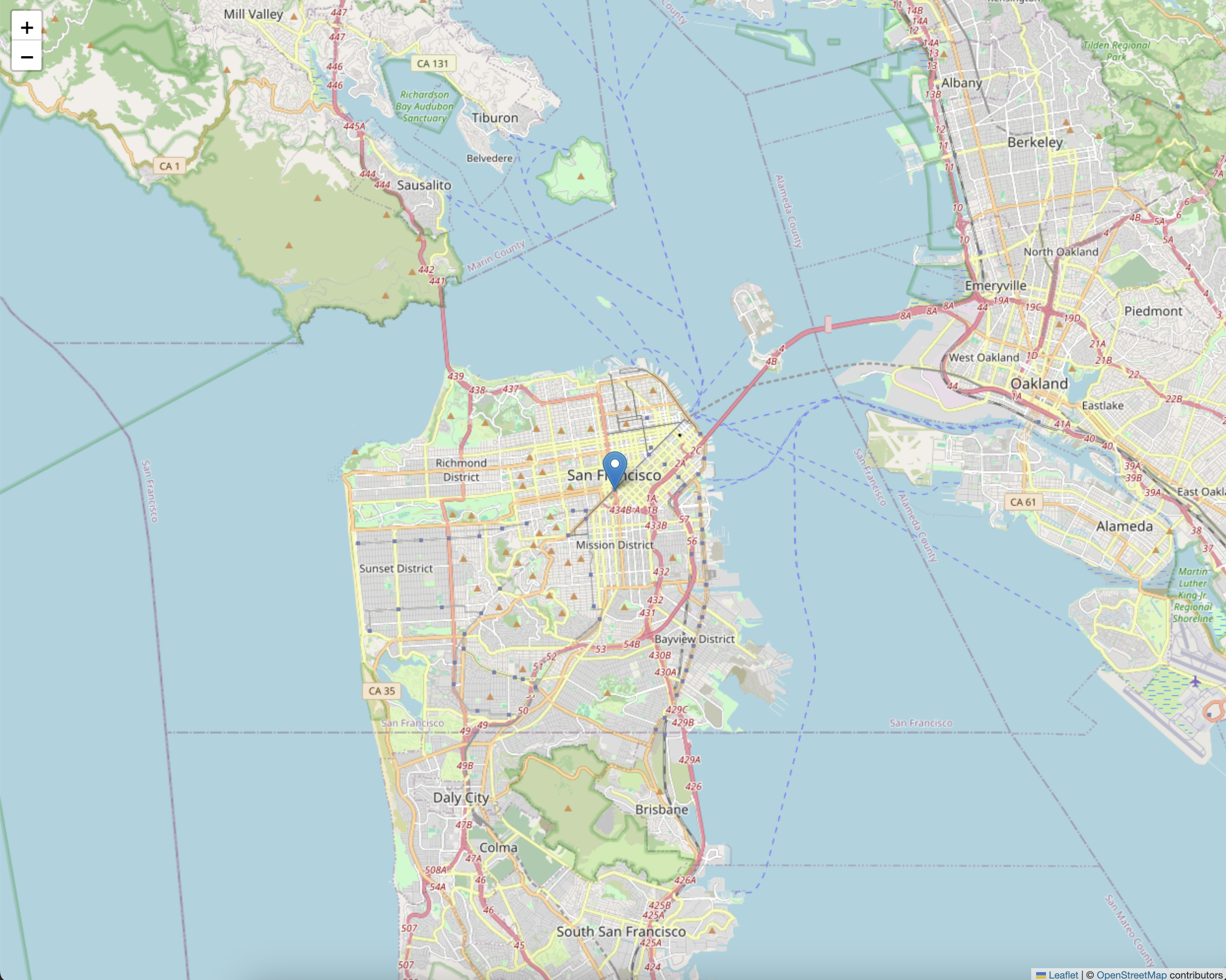
4. Folium (시각화)
import folium

m = folium.Map(location=[37.7749, -122.4194], zoom_start=12)

folium.Marker([37.7749, -122.4194], popup="San Francisco").add_to(m)
folium.Marker([40.7128, -74.0060], popup="New York").add_to(m)

m.save("map.html")  # 지도 저장
(로컬에 저장된 html 파일을 크롬으로 드래그 앤 드롭 하면 열린다.)

'Data > SQL' 카테고리의 다른 글
| [BigQuery] DECLARE, SET (0) | 2023.11.29 |
|---|